Ladakh with Hanle Motorcycle Expedition Across the Eastern Plateau
8 days · Trans-Himalaya Max riders Royal Enfield Ten departures a year

Ladakh with Hanle Motorcycle Expedition Across the Eastern Plateau

Route
10 Waypoints Circuit View Itinerary
Leh Nubra Valley Hunder Shyok Valley Pangong Tso Chushul Hanle Nyoma Chumathang Leh
Duration8DAYS RIDING
FleetRoyal EnfieldHIMALAYAN 450 CC
Group15 RidersMAXIMUM GROUP
SupportVan & MechanicEXPEDITION BACKUP
DepositInquireBOOKING TERMS

Tour Overview & Highlights

8 DAYS

This eight-day Leh-to-Leh motorcycle expedition pairs Ladakh’s classic Nubra and Pangong landscapes with a deeper journey into Changthang and Hanle. The first two days are kept gentle for acclimatisation and an introduction to Leh’s Indus Valley. The road then climbs over Khardung La to Nubra, crosses the remote Shyok corridor to Pangong Tso and continues south-east through the high plateau toward Hanle. Known for its far-reaching horizons and exceptionally dark skies, Hanle offers a quieter, more remote perspective on Ladakh. The return to Leh follows the Indus through Nyoma and Chumathang, before a final day among monasteries and royal heritage. The source itinerary lists around 930 km. Expect restricted-area procedures, sparse services and high-altitude riding that rewards patience and careful preparation.
The source tour is sold as a holiday package with motorcycle and vehicle options. This version presents the published route as a motorcycle itinerary for international riders. Daily stage distances, times and road notes are planning estimates; confirm the exact vehicle, permits, support, inclusions and live access with the operator before departure.

Trip's Video

TRANS-HIMALAYA EXPEDITION FOOTAGE

Expedition Itinerary

8 DAYS · DETAILED ROUTE
01

DAY 1 – ARRIVAL IN LEH AND A GENTLE START AT HIGH ALTITUDE

ARRIVAL IN LEH AND A GENTLE START AT HIGH ALTITUDE

Route: Leh Airport – hotel – optional short town outing

Distance: Approximately 10–20 km of transfers; no motorcycle ride planned

Riding / Activity Time: Around 3–4 hours including airport arrival, check-in and briefing

Altitude: Leh approx. 3,500 m / 11,500 ft

Road: Paved town roads; light local traffic, with uneven lanes in the old quarter

Overnight: Hotel or guesthouse in Leh

Meals: Breakfast and dinner (as per the original package)

Highlights: Arrival transfer, rest, motorcycle and gear check, Leh Old Town from a low-effort viewpoint

The first view of Leh is often a lesson in scale. Whitewashed homes gather on a dry slope beneath the old palace, while the Indus Valley opens toward mountains that seem close enough to touch and impossibly far away. At the airport, meet the local team for a transfer to the hotel. Today is intentionally quiet: the journey begins by giving the body time to adjust to the thin, dry air rather than by chasing a viewpoint. Leh sits at roughly 3,500 metres, so even a short walk can feel more demanding than expected after a flight from the plains.

Once settled, meet the ride captain and mechanic for a relaxed introduction to the motorcycles. Check the fit of the helmet, gloves and riding layers; make sure the mirrors, levers and luggage are comfortable; and learn how the support vehicle and convoy will work. A brief safety conversation should cover hand signals, safe following distance, overtaking, regrouping points and what to do if a rider feels unwell. If energy and health permit, enjoy an easy look around the nearby bazaar or a viewpoint over Leh. The old town’s lanes hold the traces of a trading centre that once linked Kashmir, Tibet and Central Asia, but the deeper heritage visit is kept for Day 8.

For the rest of the day, drink regularly, eat lightly and avoid strenuous activity and alcohol. Keep prescribed medicines in their original packaging and let the leader know about relevant medical conditions. A headache, nausea, dizziness or unusual breathlessness should be reported early; riders should never treat symptoms as a test of toughness. The local administration advises at least 48 hours of acclimatisation after arrival in Leh before travelling to higher areas such as Khardung La or Pangong. This itinerary places local sightseeing on Day 2 and the first high pass on Day 3; the operator must confirm that the actual arrival time gives a full 48 hours, or add a rest day before riding higher.

Mountain travel is best understood in the pauses as well as the miles. Leave time to drink water, adjust a layer, listen to the local team and watch how the landscape changes around each settlement. That slower rhythm helps riders notice more and make better decisions.

Safety Notification: Ride within your limits, keep the group informed and follow the road captain’s instructions. Conditions can change quickly in Ladakh.

02

DAY 2 – LEH VALLEY WARM-UP AND THE INDUS–ZANSKAR CONFLUENCE

LEH VALLEY WARM-UP AND THE INDUS–ZANSKAR CONFLUENCE

Route: Leh – Spituk – Magnetic Hill – Gurudwara Pathar Sahib – Sangam – Leh

Distance: Approximately 60–80 km round trip

Riding / Activity Time: Around 4–5 hours at an unhurried pace, including stops

Altitude: Leh approx. 3,500 m; Sangam approx. 3,200 m

Road: Mostly paved highway and local roads; dusty shoulders, traffic and occasional rough patches

Overnight: Hotel or guesthouse in Leh

Meals: Breakfast and dinner (lunch commonly arranged en route; confirm package)

Highlights: Easy acclimatisation ride, Spituk area, Magnetic Hill, Pathar Sahib and the Indus–Zanskar Sangam

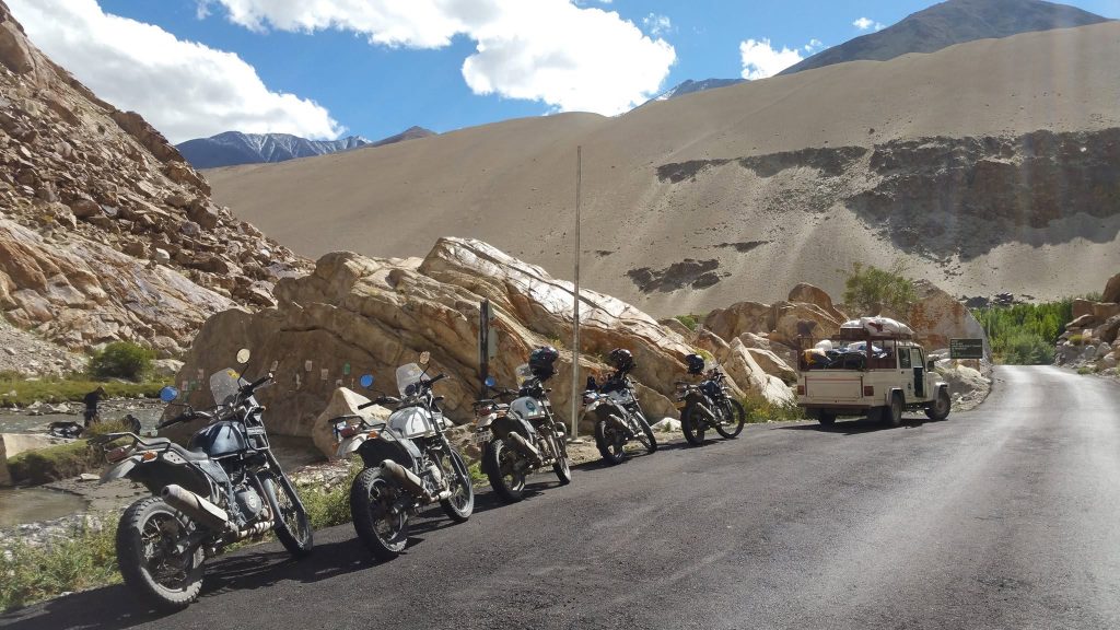
This is a gentle first day on two wheels, designed to help riders learn the motorcycle and the rhythm of Ladakh without climbing immediately toward a high pass. Leave Leh after breakfast and follow the Indus west through a broad, stony valley. The road is mostly paved and relatively straightforward, yet the altitude, dry air and strong light ask for patience. Ride at a conversational pace, keep generous space between bikes and stop only at safe pullouts. Spituk’s monastery sits above the valley near the airport; even from the road, its white buildings and hillside position introduce the close relationship between settlement, river and Buddhist practice in Ladakh.

Continue toward Magnetic Hill, a roadside landmark where the lay of the terrain creates an optical illusion that makes a stationary vehicle appear to roll uphill. It is a brief stop rather than a scientific wonder, and a useful reminder that perspective can be deceptive in a landscape this immense. Nearby, Gurudwara Pathar Sahib welcomes travellers at a site associated with Guru Nanak’s journey through the region. Visitors should remove shoes where required, cover their heads respectfully and follow local guidance. The Sangam, where the greener Zanskar River meets the Indus, is the day’s most striking natural pause. The contrasting currents and colours are easiest to appreciate from an established viewpoint; do not approach unstable banks or leave litter behind.

Return to Leh with time to rest and review the next stage. This ride remains below the elevation of the main passes, but it is still an acclimatisation day, not a fitness test. Eat and drink regularly, use sunscreen and eye protection, and keep a warm layer accessible because wind can change the feel of the day quickly. The team should recheck tyre pressure, brakes, chain, lights and luggage before the Nubra crossing. If the group has not yet completed a full 48 hours in Leh, keep tomorrow’s riding local or extend the acclimatisation period. The schedule should follow health and road conditions, not the pressure to keep a timetable.

Mountain travel is best understood in the pauses as well as the miles. Leave time to drink water, adjust a layer, listen to the local team and watch how the landscape changes around each settlement. That slower rhythm helps riders notice more and make better decisions.

Safety Notification: Ride within your limits, keep the group informed and follow the road captain’s instructions. Conditions can change quickly in Ladakh.

03

DAY 3 – CROSS KHARDUNG LA INTO NUBRA VALLEY

CROSS KHARDUNG LA INTO NUBRA VALLEY

Route: Leh – South Pullu – Khardung La – North Pullu – Khardung – Diskit – Hunder

Distance: Approximately 120–130 km

Riding / Activity Time: Around 6–8 hours with pass controls, stops and a conservative pace

Altitude: Khardung La approx. 5,359 m / 17,582 ft; Nubra settlements approx. 3,000–3,200 m

Road: Paved mountain road with narrow bends, broken or gravel sections, traffic controls and possible snow or water

Overnight: Guesthouse or camp in Nubra Valley

Meals: Breakfast and dinner; lunch en route

Highlights: Khardung La, high Himalayan viewpoints, Diskit, Nubra Valley and Hunder dunes

Depart Leh after an early breakfast, carrying water, a warm layer and rain protection where they can be reached without unpacking. The road climbs steadily through South Pullu toward Khardung La, one of the most famous high passes in Ladakh and a gateway between the Indus Valley and Nubra. The landscape thins as the hairpins rise: trees give way to rock, prayer flags snap in the wind and the horizon opens across a succession of stark ridges. Khardung La is often promoted with superlatives, but the meaningful achievement is riding it safely. The summit area can be cold, crowded and affected by traffic restrictions, so follow the marshal’s instructions and keep any stop brief.

Beyond North Pullu, the descent feels like entering another world. Nubra is lower and warmer than Leh, with villages, cultivated strips and the Shyok and Nubra rivers threading through a wide desert valley. At Diskit, the hilltop monastery and its large Maitreya statue overlook the settlement. If opening times and the group’s condition allow, visit respectfully and keep voices low around prayer spaces. Continue toward Hunder, where pale dunes sit beneath mountain walls. The Bactrian camels recall the valley’s history as part of an old Silk Route corridor, when caravans moved goods between Central and South Asia. The dunes are fragile; remain on marked areas and do not disturb wildlife or local livelihoods for a photograph.

Khardung La is a serious altitude exposure, and the road is not a place to race or prove skill. Riders should avoid abrupt braking on gravel, use low gears on descents and never stop on a blind bend or narrow bridge. Watch for military and local traffic, water crossings and surface changes. Anyone with headache, nausea, dizziness or breathlessness should tell the leader immediately; the correct response may be to descend or use the support vehicle. Keep the convoy together at agreed junctions, but leave safe spacing between motorcycles. On arrival in Nubra, drink fluids, eat a warm meal and sleep at a lower altitude than the pass. Tomorrow’s route uses the Shyok corridor, where conditions can change after rain or maintenance work.

Mountain travel is best understood in the pauses as well as the miles. Leave time to drink water, adjust a layer, listen to the local team and watch how the landscape changes around each settlement. That slower rhythm helps riders notice more and make better decisions.

Safety Notification: Ride within your limits, keep the group informed and follow the road captain’s instructions. Conditions can change quickly in Ladakh.

04

DAY 4 – RIDE THE SHYOK CORRIDOR TO PANGONG TSO

RIDE THE SHYOK CORRIDOR TO PANGONG TSO

Route: Hunder – Diskit – Khalsar – Agham – Shyok – Durbuk – Tangtse – Pangong Tso

Distance: Approximately 160–180 km

Riding / Activity Time: Around 6–8 hours; allow longer for rough surfaces, water crossings or road controls

Altitude: Pangong Tso approx. 4,225 m / 13,860 ft

Road: Remote paved and unpaved sections; loose gravel, washouts, river crossings and limited services are possible

Overnight: Guesthouse or camp near Pangong Tso

Meals: Breakfast and dinner; packed or local lunch

Highlights: Shyok Valley, Agham, Durbuk, Tangtse and the changing colours of Pangong Tso

Today follows the Shyok corridor, a remote connection between Nubra and the Pangong region. Leave Hunder early and return through Diskit toward Khalsar, where the valley narrows and the road begins to feel less like a regular highway and more like a line through immense, empty country. The Shyok River, whose name is often translated as the ‘river of death’, has shaped travel here through shifting channels, flood events and difficult terrain. The landscape offers little shade and few services, so the group should start with full fuel, water and food supplies, and listen carefully to the road captain’s briefing before leaving the last settled areas.

Beyond Agham, surfaces can vary sharply. A smooth stretch may give way to broken tarmac, gravel, dusty construction or shallow water across the road. The support vehicle should carry luggage and recovery essentials, while riders keep a calm pace and avoid riding close together in dust. Regroup only at wide, visible places. As the route approaches Durbuk and Tangtse, the terrain opens and the human presence becomes more apparent: small settlements and cultivated patches survive in a climate that leaves little margin for error. Tangtse is a useful stop to rest, check the group’s condition and confirm that the route to Pangong remains open.

Pangong Tso appears gradually, then suddenly dominates the horizon. Its long body of water shifts between steel grey, turquoise and deep blue as clouds and sunlight move across the high plateau. The lake crosses the international boundary, and visitors must stay within permitted areas and obey instructions from local authorities. The shore is not a place for swimming: the water is extremely cold, weather can turn quickly and the ecosystem is fragile. At the overnight camp or guesthouse, dress warmly even in summer, as the temperature drops after sunset. This stage is remote, so carry personal medication, keep a charged phone and power bank, and never leave the group without telling the leader. Tomorrow moves farther east toward Hanle via the Chushul route, subject to current permits and access.

Mountain travel is best understood in the pauses as well as the miles. Leave time to drink water, adjust a layer, listen to the local team and watch how the landscape changes around each settlement. That slower rhythm helps riders notice more and make better decisions.

Safety Notification: Ride within your limits, keep the group informed and follow the road captain’s instructions. Conditions can change quickly in Ladakh.
05

DAY 5 – ACROSS CHANGTHANG TO HANLE

ACROSS CHANGTHANG TO HANLE

Route: Pangong Tso – Man – Merak – Chushul – Tsaga La area – Loma – Hanle

Distance: Approximately 150–180 km, depending on the permitted route and road status

Riding / Activity Time: Around 6–8 hours, potentially longer at checkpoints or on rough sections

Altitude: Hanle approx. 4,500 m / 14,760 ft; several high sections above 4,500 m

Road: Remote high-altitude road, mixed paved and gravel surfaces, exposed plateau and possible restrictions

Overnight: Guesthouse or homestay in Hanle

Meals: Breakfast and dinner; lunch en route

Highlights: Pangong’s southern shore, Changthang plateau, Chushul region, Loma and Hanle village

The road leaves Pangong’s familiar northern shore and turns into the immense spaces of Changthang. Small villages such as Man and Merak sit beside the water, their fields and stone homes held in a narrow band between lake and mountain. Beyond them, the route follows the southern side of the lake toward Chushul and the open plateau. This is a border region, so the exact route must be confirmed with the operator and authorities before departure. Foreign visitors may require permits for protected or restricted areas, and access rules can change. Carry the required documents, keep them accessible, and never photograph installations or personnel where signs or officials prohibit it.

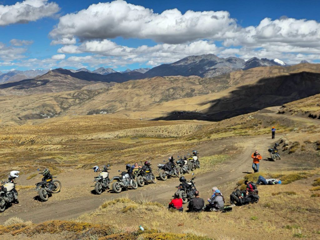
The riding is less about cornering than concentration. Long exposed stretches, thin air, loose gravel and weather moving across the plateau ask for a steady throttle and an unhurried pace. The landscape can feel almost lunar: broad, pale valleys, dark ridgelines and occasional grazing grounds where Changpa pastoralists move with their herds. These high-altitude communities have adapted their lives to seasonal migration and severe winters. If a chance encounter arises, greet people respectfully, ask before photographing, and avoid approaching livestock or tents without invitation. Chushul’s history is closely tied to the frontier, so the guide should explain what can be visited and what must remain private or off-limits.

Continue toward Loma and Hanle, where a cluster of whitewashed homes rests in a wide, quiet valley. Hanle is known for its high-altitude observatory and extraordinarily dark skies, although an observatory visit must be arranged and is never guaranteed by the itinerary. Even without a formal visit, the night sky can be unforgettable when clouds, moonlight and local conditions cooperate. The altitude is high enough to affect sleep, appetite and breathing, so keep the evening calm and report symptoms promptly. Drink steadily, layer clothing against wind chill, and do not walk uphill to chase a viewpoint. Today’s remoteness makes contingency planning essential: maintain the convoy, carry sufficient fuel and water, and be prepared for an overnight change if road closures or health concerns require it.

Mountain travel is best understood in the pauses as well as the miles. Leave time to drink water, adjust a layer, listen to the local team and watch how the landscape changes around each settlement. That slower rhythm helps riders notice more and make better decisions.

Safety Notification: Ride within your limits, keep the group informed and follow the road captain’s instructions. Conditions can change quickly in Ladakh.
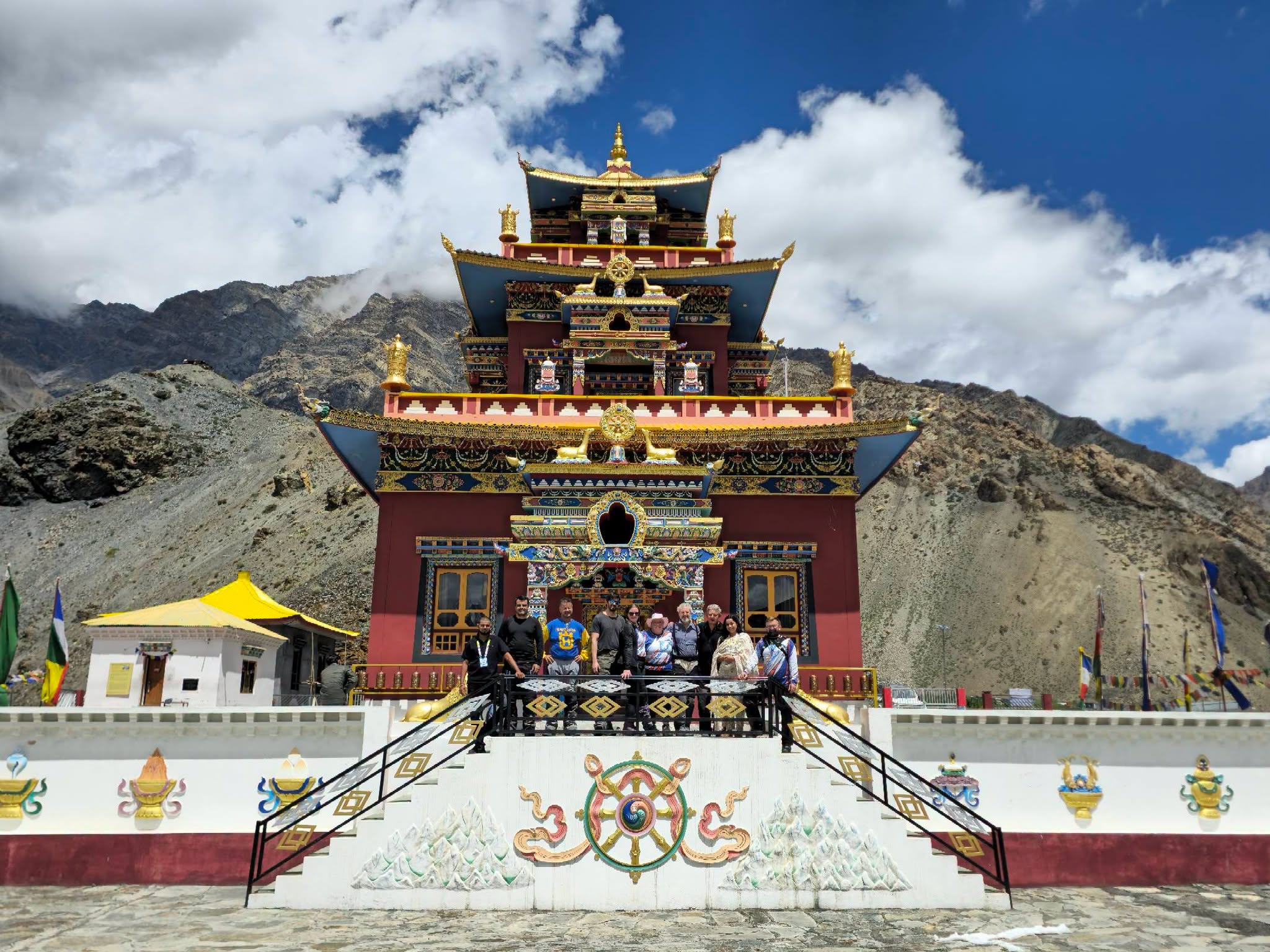
06

DAY 6 – HANLE TO LEH THROUGH NYOMA AND CHUMATHANG

HANLE TO LEH THROUGH NYOMA AND CHUMATHANG

Route: Hanle – Loma – Nyoma – Mahe – Chumathang – Upshi – Leh

Distance: Approx. 250–280 km

Riding / Activity Time: Around 8–10 hours depending on route, permits, surface and stops

Altitude: Hanle approx. 4,500 m / 14,760 ft; Leh approx. 3,500 m / 11,500 ft

Road: Remote plateau roads with long gravel sections, exposed surfaces, possible water crossings and limited fuel or phone coverage

Overnight: Hotel or guesthouse in Leh

Meals: Breakfast and dinner; packed lunch or local stop

Highlights: Hanle village, Nyoma, Mahe, Chumathang hot springs and the Indus Valley

Leave Hanle early, after confirming road access, weather and fuel. The first kilometres cross an open plateau where the horizon seems to shift with every change in light. Hanle is known for its astronomical observatory and remarkably dark skies, but the observatory is a working scientific facility and access must be arranged separately. Even without a formal visit, the village reveals the quiet resilience of life in Changthang: low houses, grazing land and long distances between services. As the road turns toward Loma and Nyoma, remain attentive to gravel, corrugations and the possibility of military or local traffic.

Nyoma and Mahe offer rare points of human scale in this wide landscape. The route crosses the Indus and gradually moves through valleys where water supports small settlements and grazing. Near Chumathang, geothermal springs send steam into the cold air, an unexpected sight in a region defined by dry mountains. The hot water and mineral ground are natural features, not a bathing facility; keep to established paths and follow local guidance. This is also a useful place for a proper break, a warm drink and a check-in with the group. Riders should not use the stop to push on if anyone is unwell or fatigued.

Continue toward Upshi and follow the Indus back toward Leh. The changing landscape is almost theatrical: isolated plateau gives way to villages, fields and bridges, while the road becomes more travelled. Even so, this remains a long day after remote high-altitude nights. Fatigue can affect judgement late in the ride, so regroup regularly and let the support team manage the pace. In Leh, complete a bike inspection and take time to eat, hydrate and rest. The tour’s next day in the Indus Valley will be gentler, but the group should still pay attention to how its members feel after several consecutive days above 4,000 metres.

Mobile signals and repair services are unreliable for much of this stage. Carry the day’s essentials on the motorcycle, protect documents from dust and water, and do not separate from the convoy. The guide should confirm fuel availability before departure and arrange the backup vehicle’s meeting points.

Safety Notification: This is a long, remote return stage. Confirm fuel and permissions before leaving Hanle, carry water, food, warm clothing and medication, and report symptoms early. Use only approved roads and avoid stopping in restricted areas.

07

DAY 7 – LEH HERITAGE RIDE MONASTERIES AND ROYAL PALACES

LEH HERITAGE RIDE MONASTERIES AND ROYAL PALACES

Route: Leh – Shey – Thiksey – Hemis – Stok area – Leh

Distance: Approx. 60–90 km round trip

Riding / Activity Time: Around 5–7 hours including visits

Altitude: Leh and Indus Valley approx. 3,200–3,600 m

Road: Mostly paved valley roads with village lanes and local traffic

Overnight: Hotel or guesthouse in Leh

Meals: Breakfast and dinner; lunch in the valley

Highlights: Shey Palace, Thiksey Monastery, Hemis Monastery and optional Stok heritage visit

After the remote plateau, today’s ride follows the Indus through a more settled Ladakh. The route passes fields, poplar-lined lanes and villages where irrigation channels bring life to the dry valley. At Shey, the former royal palace and monastery recall the period when Ladakh’s rulers held court in the Indus corridor. The remains sit above the fields, and the view explains why this place mattered: it commands the valley without standing apart from the agricultural life that sustained it. Walk slowly, respect quiet spaces and ask before photographing people at prayer or work.

Thiksey Monastery rises in tiers above the road, its white buildings often compared in silhouette to the Potala Palace in Lhasa. It is a living Gelugpa monastery, not a museum set, and visitors should dress modestly, remove shoes where indicated and follow signs about photography. If a prayer session is underway, listen quietly from the designated area rather than interrupting. Continue to Hemis, one of Ladakh’s largest and most influential monasteries, associated with the Drukpa Kagyu tradition. Its courtyards, murals and collection spaces offer a glimpse into a religious world shaped by Himalayan networks of teachers, patrons and pilgrimage. Festival dates vary by lunar calendar, so a festival experience cannot be promised unless dates are confirmed separately.

If time and opening hours allow, a short stop around Stok can add another layer of royal history through its palace and museum collections. The day’s pacing should leave room for conversation with a knowledgeable local guide, who can explain how Buddhism, trade, agriculture and seasonal movement shaped the valley. On a motorcycle, keep the group respectful in village streets: reduce speed, avoid revving near monasteries and give pedestrians and livestock priority. A day of heritage may appear gentle after the high passes, but altitude and accumulated fatigue still count. Return to Leh in the afternoon, check the next day’s flight time and repack carefully. The aim is to leave Ladakh with more than photographs: with a clearer sense of the communities whose traditions have endured in this high, demanding landscape.

Mountain travel is best understood in the pauses as well as the miles. Leave time to drink water, adjust a layer, listen to the local team and watch how the landscape changes around each settlement. That slower rhythm helps riders notice more and make better decisions.

Safety Notification: Ride within your limits, keep the group informed and follow the road captain’s instructions. Conditions can change quickly in Ladakh.

08

DAY 8 – DEPARTURE FROM LEH

DEPARTURE FROM LEH

Route: Hotel – Leh Airport

Distance: Approx. 5–10 km by transfer; no motorcycle ride planned

Riding / Activity Time: Around 30–60 minutes, excluding airport check-in

Altitude: Leh approx. 3,500 m / 11,500 ft

Road: Paved town roads; allow extra time for airport procedures

Overnight: Not applicable

Meals: Breakfast, subject to departure time

Highlights: Hotel check-out and transfer to Leh Airport

The final morning is deliberately uncomplicated. After breakfast, complete check-out and transfer to Leh Airport for your onward flight. If departure is later in the day, a short walk near the hotel may be possible, but leave time to rest, organise luggage and confirm transport with the operator. Leh’s airport operations can be affected by weather, and flights across the mountains may change with conditions. Keep essential medication, travel documents, valuables and a warm layer in your hand luggage rather than in checked baggage. If the tour has experienced road or weather delays, avoid making a tight onward connection; a buffer night in Leh can protect the rest of your travel plans.

Over nine days, the route has moved through several different Ladakhs: the old trading town of Leh, Nubra’s river and desert corridor, Pangong’s enormous border lake, Changthang’s pastoral plateau and the wetlands of Tso Moriri and Tso Kar. The ride has also crossed landscapes shaped by Buddhist monasteries, royal histories, caravan routes and contemporary frontier realities. These places are not empty backdrops. They are home to Ladakhi, Balti and Changpa communities, and their daily lives continue alongside tourism. Carry that awareness with you: share photographs thoughtfully, avoid geotagging sensitive locations where restricted, and remember that quiet, respectful travel helps protect the character of the region.

Before leaving, check that you have all belongings, passport and permit copies, medicines, camera cards and charging equipment. Tell the leader if you experienced persistent headache, breathlessness, nausea or unusual fatigue during the tour; symptoms can continue after descending. Riders should follow medical advice before flying if they feel unwell. The motorcycle team can complete a final handover and note any equipment issues. This itinerary is designed for the main riding season, but mountain weather can alter access from late May through October, and October nights are cold. What remains most vivid is often not a single pass but the small details between them: a monastery bell, the colour of a lake changing under cloud, the scent of apricot woodsmoke, or the patient wave of someone tending fields beside the road.

Mountain travel is best understood in the pauses as well as the miles. Leave time to drink water, adjust a layer, listen to the local team and watch how the landscape changes around each settlement. That slower rhythm helps riders notice more and make better decisions.

Safety Notification: Ride within your limits, keep the group informed and follow the road captain’s instructions. Conditions can change quickly in Ladakh.

Two Bikes, Your Call

SERVICED NIGHTLY BY EXPEDITION MECHANIC

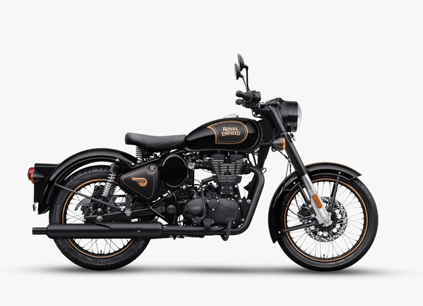
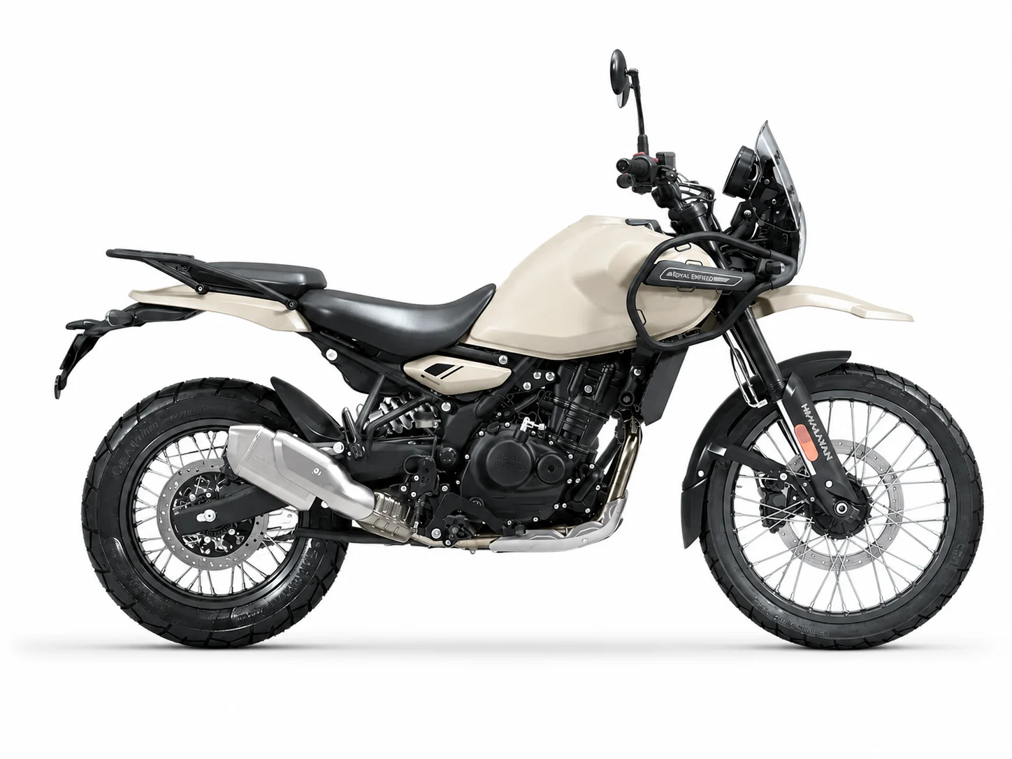
Both are legendary Royal Enfields engineered to conquer the roof of the world. The difference lies in your riding style: the classic low-end thumping torque and grounded stability of the Classic 500, or the long-travel suspension, modern power, and agile clearance of the Himalayan 450 across river crossings and high-altitude passes.

TRADITIONAL · 499 CC Royal Enfield Classic 500

Royal Enfield Classic 500

The traditional choice · torquey, low-slung, indestructible

Heavy iron single-cylinder. It tractors over high passes at 2,000 RPM where revvier motors run out of air. 800 mm seat height keeps both feet flat in rocky stream crossings.

  • Engine499 cc single, air-cooled
  • Power / Torque27 bhp · 41.3 Nm @ 4,000 RPM
  • Kerb weight195 kg
  • Seat height800 mm
  • Fuel capacity13.5 L
ALL-TERRAIN · 452 CC Royal Enfield Himalayan 450

Royal Enfield Himalayan 450

Long-travel adventure · higher ground clearance, 21-inch front

Built specifically for this terrain. 200 mm suspension travel absorbs washboard gravel and rocky climbs that tire wrists on the Classic. 21-inch front wheel rolls easily through rubble.

  • Engine452 cc liquid-cooled Sherpa
  • Power / Torque40 bhp · 40 Nm @ 5,500 RPM
  • Kerb weight196 kg
  • Seat height825–845 mm adjustable
  • Fuel capacity17 L

Important Expedition Advice · Read Before Riding

10 ESSENTIAL NOTES
01

Acclimatise in Leh for at least 48 hours before riding to higher destinations such as Khardung La, Pangong or Changthang. Keep arrival days gentle; add a rest day if the schedule does not provide the full acclimatisation period.

02

Speak with a doctor before travel about high-altitude riding, existing medical conditions and any medication. Report headache, nausea, dizziness, unusual fatigue, poor coordination or breathlessness immediately; do not continue ascending when unwell.

03

Bring a correctly fitted full-face helmet, protective jacket and trousers, gloves, riding boots, thermal base layers, insulating mid-layer, waterproof and windproof outer layer, neck protection, eye protection and sun protection.

04

Carry your passport, visa, driving documents and required protected-area permits. Foreign visitor access and route permissions can change; confirm them with the operator before departure and keep copies accessible at checkpoints.

05

Expect long gaps between fuel, food, mobile signal, repair shops and medical facilities. Confirm fuel strategy, support-vehicle arrangements, emergency communications, spare parts and first-aid capability before the tour.

06

Ride at a pace suitable for the surface and altitude. Keep safe spacing, use engine braking on descents, avoid blind overtakes, regroup only in safe places and never ride alone ahead of or behind the convoy.

07

Mountain weather can change rapidly from May to October. June to September is generally the most practical period for the full routes; late May and October are more conditional, with snow, cold nights, reduced services or closures possible.

08

Stay on approved roads, obey military and local instructions, avoid photographing restricted sites, respect monasteries and village privacy, keep away from wildlife and wetlands, and carry all rubbish back to town.

09

Purchase travel insurance that expressly covers motorcycle use at the engine capacity supplied, high-altitude travel, medical treatment and emergency evacuation. Keep policy details and emergency contacts with you.

10

If a road or pass is closed, or a rider becomes unwell, follow the ride leader’s safe alternative, delay or descent plan. Do not attempt unofficial shortcuts or continue solely to keep the schedule.

What Contact covers

PER RIDER · 8 DAYS · ALL-INCLUSIVE EXPEDITION
What's Included
  • Royal Enfield Classic 500 or Himalayan, your choice, with all fuel included
  • Nightly servicing by the expedition mechanic, who rides with the group
  • Three support vehicles and around ten crew for a maximum of fifteen riders
  • All accommodation — hotels, fixed camps at Chandratai and Sarchu, boutique stays
  • All meals on the road: hot breakfasts, roadside lunches and camp dinners by expedition chef
  • Inner Line Permits and environmental access fees for Ladakh and Changthang
  • Medical support: two 47 L oxygen cylinders, comprehensive trauma kit, satellite communications
What's Excluded
  • International flights into India and domestic flights into Bhuntar/Kullu or Leh
  • Comprehensive travel and medical insurance with high-altitude motorcycle cover
  • India visa fees and processing
  • Alcohol, personal bar bills, laundry and optional tips
  • Riding gear (helmet, armored jacket, gloves, boots)
  • Refundable security deposit for motorcycle damage ($400)

Price & Reservation

TRANSPARENT EXPEDITION PRICING · DIRECT BOOKING
Per rider, all-inclusive expedition
Contact
Deposit to hold a place
Balance due60 days before departure
Group sizeMaximum riders
GUARANTEED RUNS

All tours operate with a minimum group size, backed by 3 support vehicles, lead rider, mechanic, luggage truck and expedition chef. Deposit refundable up to 60 days before ride.

TALK TO A LOCAL EXPERT

Need more information about this expedition? Our tour specialists are ready to help.

WhatsApp Us

Frequently Asked Questions

Is this route suitable for first-time motorcyclists?

It is better suited to riders with recent motorcycle experience. High altitude, long days and remote mixed-surface roads can be demanding. Confirm the bike, support vehicle and required skill level with the operator.

When is the best time to ride this route?

June to September is generally the most practical window for the full circuit. Late May and October depend more heavily on snow clearance, weather, road access and local services.

How long should I acclimatise in Leh?

Plan at least 48 hours in Leh before riding to higher areas. Keep the first outings easy and add another night if arrival timing does not provide the full acclimatisation period.

Do I need permits for Hanle and Pangong?

Some eastern Ladakh areas require permits or are subject to restricted access. Confirm current requirements for every section with the operator and carry the requested documents.

How difficult is the riding?

Expect paved mountain highways, gravel, rough patches, exposed passes and long remote stretches. The route is moderate to challenging, with conditions changing by season and weather.

Will I have mobile phone coverage throughout the tour?

No. Coverage can be weak or absent on remote sections. Confirm the operator’s emergency communication and support-vehicle plan before departure.

Can the itinerary change?

Yes. Snow, roadworks, weather, security instructions, permits and rider health may affect access. The ride leader should use a safe authorised alternative or delay the stage.

What should I pack?

Bring full protective riding gear, thermal and waterproof layers, warm gloves, eye and sun protection, personal medication, identification and travel insurance documents.

Is Pangong Lake safe for swimming?

No. The water is extremely cold, weather changes quickly and the lake environment is fragile. Stay on permitted shore areas and follow local instructions.

What happens if I feel unwell at altitude?

Tell the ride leader immediately and do not continue ascending. Follow the operator’s descent and medical plan; seek medical advice if symptoms persist or worsen.

TripAdvisor Reviews

VERIFIED TRAVELER FEEDBACK
EXCELLENT
Tripadvisor star 1Tripadvisor star 2Tripadvisor star 3Tripadvisor star 4Tripadvisor star 5
Based on 207 reviews
Posted on Tripadvisor Tripadvisor
Garry A profile picture
Garry A
Tripadvisor star 1Tripadvisor star 2Tripadvisor star 3Tripadvisor star 4Tripadvisor star 5Verified
Awesome Riding Adventure 5 of us did the 10 day Northern Vietnam Off-road Loop at the end of November, very ably assisted by by our guide, Giang, and support vehicle driver, Dong.We logged over 1800km in 9 days of riding, saw some absolutely amazing scenery, partook in local delicacies, met and partied with ethnic people and had an epic trip.Everything around the trip was managed efficiently by Mike Dong, including organising Vietnamese drivers licences for us all. The bikes we had (CRF300L) performed well with only two flat tyres to speak of. The accommodation choices (apart from one night) were comfortable and adequate, the meals were delicious and plentiful.The whole trip went like clockwork and we got to see places few other tourist would ever get to see.I would definitely recommend this tour or shorter trips if you feel 10 days is a bit much.
Posted on Tripadvisor Tripadvisor
Go21589563690 profile picture
Go21589563690
Tripadvisor star 1Tripadvisor star 2Tripadvisor star 3Tripadvisor star 4Tripadvisor star 5Verified
Unforgettable 12-day trip from Hanoi to Saigon We highly recommend the 12-day trip from Hanoi to Saigon. The organization was excellent from start to finish. The day before, we were personally briefed by the company owner, received all important details and felt well prepared.Our guide Cong was just awesome. We felt safe at all times and were allowed to experience small cultural excursions practically every day. He showed us beautiful places, introduced us to local culture and was able to tell us an incredible amount about the country. We were also spoiled culinary – we ate very fine every day.An absolutely unique experience, perfectly organized and with a guide who made our experience unforgettable. Clear recommendation!
Posted on Tripadvisor Tripadvisor
P w profile picture
P w
Tripadvisor star 1Tripadvisor star 2Tripadvisor star 3Tripadvisor star 4Tripadvisor star 5Verified
Great bike tour for 6 days, north west Vietnam Brilliant 6 days, the tours are road based with a little bit of riding on un paved roads, Ducky was our guide, ex-road racer which suited us as we like to push on. Was amazing to see all the villagers, people waving, nothing like miserable old England where everyone thinks your doing something illegal. Homesteads were great, food nothing to say as always the best. Get it booked and take your holiday to +10.
Posted on Tripadvisor Tripadvisor
Ian W profile picture
Ian W
Tripadvisor star 1Tripadvisor star 2Tripadvisor star 3Tripadvisor star 4Tripadvisor star 5Verified
Am absolutely amazing ten days in northern Vietnam We did a 10 day tour. Lihn was our guide. Great guy. We had a Canadian guy join us, so 4 in total. Amazing time, 10 days few by. I had a gopro on my helmet facing forward, Lihn had one facing back. Michael, the owner has put all the footage together and made a great video.We are now looking at another trip with these guys.
Posted on Tripadvisor Tripadvisor
Compass40778616391 profile picture
Compass40778616391
Tripadvisor star 1Tripadvisor star 2Tripadvisor star 3Tripadvisor star 4Tripadvisor star 5Verified
Incredible life experience Indochina Bike Tours ran a very relax but very professional motorcycle tour and over the 14 day North Vietnam,2400km ride everyday was full of challenges and wonder natural and cultural surprise.Absoulutly everything was fully catered for and supplied , all you have to do is wake up and thumb the starter button.Great company and great ride.Highly recommended. Absoulutly incredible experience.
Posted on Tripadvisor Tripadvisor
Niels M profile picture
Niels M
Tripadvisor star 1Tripadvisor star 2Tripadvisor star 3Tripadvisor star 4Tripadvisor star 5Verified
Unic and special experience Great adventure, the guide and the driver where verry kindly.A lot of adventure, drinke and food.Verry nice experience
Posted on Tripadvisor Tripadvisor
erik m profile picture
erik m
Tripadvisor star 1Tripadvisor star 2Tripadvisor star 3Tripadvisor star 4Tripadvisor star 5Verified
Very good We where with 4 guys and had a great time!Great stays with good food and vieuws, also beautiful roads and offroad paths.Our guide Son was a very good and funny guy! Thank you all for this awesome time!
Posted on Tripadvisor Tripadvisor
jvbn profile picture
jvbn
Tripadvisor star 1Tripadvisor star 2Tripadvisor star 3Tripadvisor star 4Tripadvisor star 5Verified
Great 12 Day Tour through Northern Vietnam We had a great trip with Ducky and Son showing us hidden offroad tracks and beautiful sceneries in Northern Vietnam. They were also very professional whenever something on the bike required fixing. The homestays and hotels were well selected, providing a great experience of local culture and cuisine. Can highly recommend the trip!
Posted on Tripadvisor Tripadvisor
Getaway28493855013 profile picture
Getaway28493855013
Tripadvisor star 1Tripadvisor star 2Tripadvisor star 3Tripadvisor star 4Tripadvisor star 5Verified
Great tour! Riding with Insochina motorbike tour was a great experience. This was my first time on a motorbike tour and my first time in Vietnam. Our guide Tony was excellent.
Posted on Tripadvisor Tripadvisor
Rochelle E profile picture
Rochelle E
Tripadvisor star 1Tripadvisor star 2Tripadvisor star 3Tripadvisor star 4Tripadvisor star 5Verified
10 Days Completed the 10 Day trip. It was guided and tailored to our riding abilities. Sadly we came at a time with flooding and could not complete some tracks because of this. The food was amazing at every location. Homestays were fantastic, nice people. Ducky had good knowledge about the locations and good recommendations

Comments & Discussion

SHARE YOUR THOUGHTS
guest

0 Comments
8 DAYS EXPEDITION Contact
Reserve